DISASTER MANAGEMENT USING DRONE
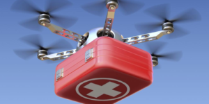
Drones are very handy when in case of emergency and natural calamities. They can be deployed instantly at any emergency site for the assessment.

Drones offer a great opportunity to assess information from significant incidents and large-scale events that can provide additional situational awareness to the incident commander. This information-gathering capability can help keep firefighters and other respondent from unnecessary danger. While engaged in situational awareness, these devices can be equipped with video cameras to capture video and/or provide a live video feed. UAVs equipped with cameras (video and infrared) can also provide a real-time overview on the spread of wild land fires and the potential harm to firefighters, the public and the surrounding communities.
Drones are already used for mapping the disaster caused by floods. Various country have used drones for flood risk mapping and management
Drones are used in earthquake disaster mapping in various countries. It is very helpful as we can get the bird’s eye view of what disaster the earthquake has caused. In a natural disaster, evacuating and finding survivors is the main goal. However, if damage is significant, reaching areas can either be a major challenge, or dangerous. Therefore, drones provide a fast and safe way to scan for potential hazards, and people. Additionally, drones can cover larger areas much faster than teams on the ground.

